12 September 2023

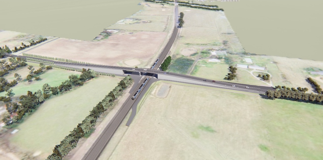
Aerial view looking south at the new road bridge at Watsons Road, Diggers Rest. Artist impression only, subject to change.
We’re removing the level crossings at Old Calder Highway and Watsons Road, Diggers Rest in 2025.
During the design and development of this project we looked at a range of road and rail solutions and assessed the benefits to the local community and wider transport networks.
Engineering and technical assessments have determined that the best way to remove the level crossings at Old Calder Highway and Watsons Road is by building road bridges.
At Old Calder Highway, the new road bridge will start south of the existing level crossing and connect Old Calder Highway to Diggers Rest– Coimadai Road.
The new road bridge at Watsons Road will be located along the same alignment as the existing road, passing over the rail line.
What we considered
Each level crossing has its own set of characteristics to consider when preparing to remove it.
Some of our key considerations when selecting a removal method are:
- traffic movements
- site constraints
- construction impacts to the community
- technical aspects of how a solution can be built
- community feedback
- disruption to train services and road users
- land and property acquisition requirements
- impacts to surrounding residential, commercial, and development areas
- land required within the project area
- impacts to utilities and services
- ground and environment conditions
- land features and surfaces
- environmental and cultural heritage impacts of the design
- future proofing the design for growth and transport needs.
Learn more about how we manage Aboriginal cultural heritage at our sites
Visit this link to learn more about our Cultural Heritage Management Plans for the Diggers Rest level crossing removals.
Cultural heritage assessments
To ensure we manage Aboriginal cultural heritage in the Diggers Rest area, we engage archaeologists, heritage advisors and the Registered Aboriginal Party (RAP), the Wurundjeri Woi-wurrung Cultural Heritage Aboriginal Corporation, to identify Aboriginal places or objects in the project area.
We conduct investigations in collaboration with the Wurundjeri Woi-wurrung Cultural Heritage Aboriginal Corporation. We then assess the extent to which our proposed design and construction approach could impact on Aboriginal places, and explore how any impacts can be avoided, minimised or mitigated.
This information then helps us prepare a Cultural Heritage Management Plan (CHMP) in accordance with the Aboriginal Heritage Act 2006. The CHMP helps us manage and protect Aboriginal cultural heritage.
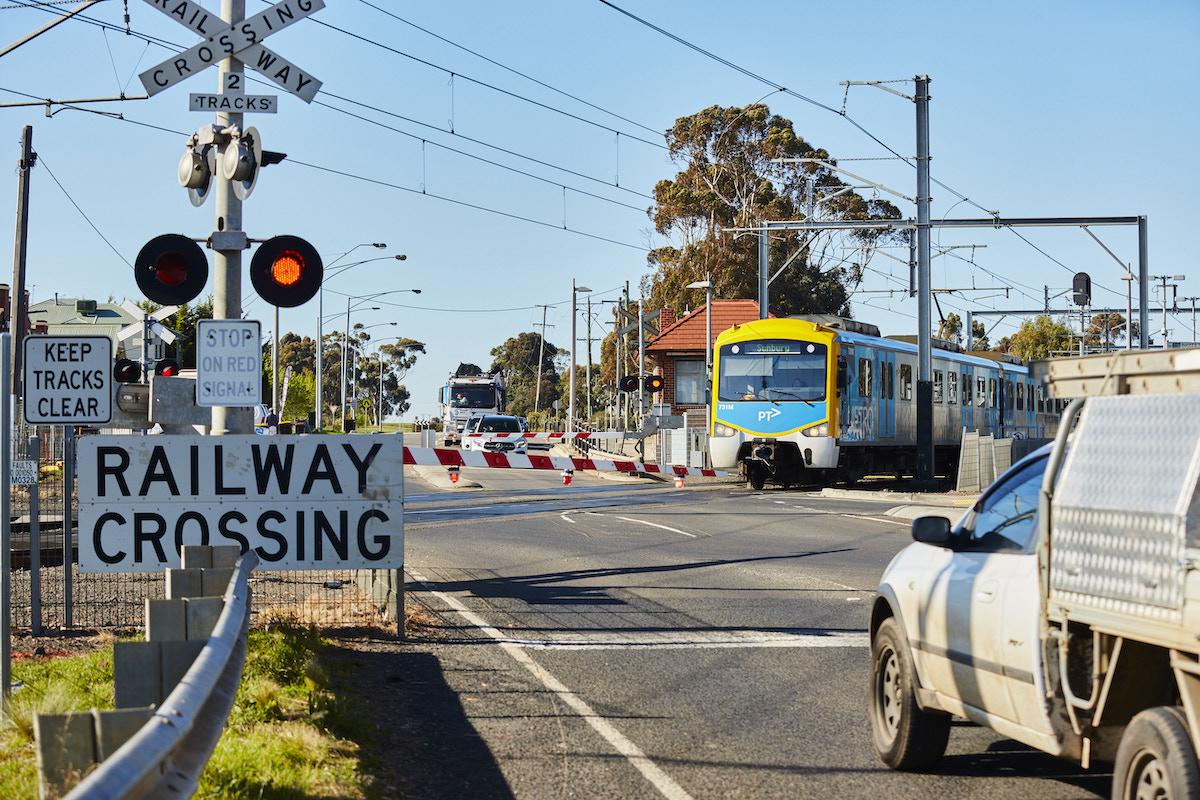
A train passing through the level crossing at Old Calder Highway, Diggers Rest.
Selecting the best design for Old Calder Highway
Understanding the area
The Old Calder Highway level crossing is near many facilities and services of significance to the community.
The Diggers Rest Station is located next to the level crossing and provides access to the metro train network in Victoria. The station and surrounding precinct were upgraded in 2012 as part of the Sunbury Electrification Project.
Many established and future residential sites surround the area near the level crossing. Vacant land near the level crossing will soon be home to new families as the suburb grows, and many existing properties are the homes of families who have been in the area for generations. There are also community services and businesses located nearby.
There are also three heritage-listed and protected sites near the level crossing: Diggers Rest Station, the lone grave of JA Sanger, and the Old Diggers Rest School Building. Essential services like a power supply substation and a large sewer pump station are also located in the project area, servicing Diggers Rest and Sunbury.
The environment surrounding the project area is relatively undeveloped, meaning there are likely to be areas of Aboriginal cultural significance and existing habitats of local flora and fauna, including endangered and protected species.
The confirmed design – road over rail
This road bridge design:
- does not impact heritage listed sites
- creates new community spaces and preserves land for the Diggers Rest Bowls Club future expansion
- improves travel times and community safety
- provides better connections for pedestrians and cyclists with a new bike path on the bridge and improved pedestrian pathways
- minimises disruptions to road users, commuters and nearby residents and businesses during construction
- requires less relocation of essential services and utilities.
Designs that are not feasible
Road over rail through the station carpark
A road bridge at this location would:
- require the relocation of large underground essential services
- significantly disrupt commuters during the construction
- require more land acquisition to build an offset car park
Road over rail connecting to the west of Diggers Rest
A road bridge in a different location would:
- increase local travel times
- divide the town, limiting access across the rai line
- require more property acquisition and impact future-proofing plans for the area
- impact sensitive areas of Aboriginal cultural heritage and local flora and fauna.
Rail over road
A rail bridge would:
- considerably extend the construction period by up to two years, disrupting residents, businesses, and road and rail users
- impact critical utilities and essential services
- not fit within the available space between the existing level crossing area and the Calder Freeway bridge
- impact heritage-listed sites and sensitive areas of Aboriginal cultural heritage and local flora and fauna.
Road or rail under
A rail trench or road underpass would:
- considerably extend the construction period by up to two years, disrupting residents, businesses, and road and rail users
- impact critical utilities and essential services
- impact heritage-listed sites, local businesses, and community facilities in the area
- impact sensitive areas of Aboriginal cultural heritage and local flora and fauna.
Selecting the best design for Watsons Road
Understanding the area
Watsons Road is home to many established residential and acreage properties, as well as vacant lots identified for future urban development.
Parcels of land surrounding the level crossing have been marked for residential developments as part of the Sunbury South Precinct Structure Plan. The project area is also relatively close to the future urban growth projects and transport projects, like the Yirrangan Road link project and the development of the future Sunbury South Station.
A number of essential services and utilities run above and under the ground near the Watsons Road level crossing, including a gas distribution system, large gas transmission main and sewer main. These facilities service the Diggers Rest and Sunbury areas.
The environment at Watsons Road is also home to protected species of flora and fauna, such as the plains grassland and golden sun moth, and is likely also habitat of the growling grass frog.
The project area is located near several sites of Aboriginal cultural significance and heritage.
The confirmed design
Road over rail
This road bridge design will:
- make local journeys safer and more reliable
- help future proof the area for planned development
- not prelude further development to transport infrastructure and urban growth in the area
- reduce impacts to critical above ground and underground services
- prevent longer term rail disruptions throughout the project’s construction phase.
Design that is not feasible
Road or rail under
A rail trench or road underpass would:
- considerably extend the construction period
- significantly disrupt residents and road and rail users during the construction period
- increase the chance of disrupting flora, fauna, undiscovered cultural heritage sites and artefacts.
- the same considerations and issues also apply to a rail over road design.
Project benefits
The Diggers Rest level crossing removals will build on the Victorian Government's $27 billion investment in transport improvements in Melbourne's west.
Combined with the Metro Tunnel, it will give Sunbury Line passengers direct access to five new underground stations, including connections to the City Loop, and will allow trains to travel 100km from Sunbury to Cranbourne and Pakenham without a single level crossing.
Other benefits of these designs include:
- Safer local roads and improved travel times
- Improved walking connections and pathways
- No loss of car parking at Diggers Rest Station
- No impacts to heritage listed sites in the area, like the Diggers Rest Station building
- New pedestrian and cyclist connections at Old Calder Highway and Watsons Road
- New, longer bus bays to the west of Diggers Rest Station
- Avoids major service relocation and disruptions to utilities
- Reduced disruptions and impacts during construction.
Project timeline
Late 2022 – early 2023
- Site investigations and planning works
June – July 2023
- Site investigations continue
- Community consultation
September 2023
- Concept designs released
- Further community consultation
2024
- Construction begins
2025
- Level crossings removed
*Timeline subject to change
Stay up to date
- SMS alerts, text DIGGERS to 0427 840 967 to keep informed of major traffic and construction impacts
- subscribe to our Diggers Rest email list
- call us on 1800 105 105 or send an email to contact@levelcrossings.vic.gov.au.
- for more information about the project, visit the project homepage.
