19 September 2024
Making Brunswick boom gate free
We're removing 8 more dangerous and congested level crossings on the Upfield Line from Albion Street, Brunswick, to Park Street, Parkville.
We've already removed 5 level crossings on the Upfield Line and in 2030, another 8 will be gone for good at Albion Street, Hope Street, Victoria Street, Albert Street, Dawson Street, Union Street and Brunswick Road in Brunswick, and Park Street in Parkville.
We’re removing the level crossings by building a 2.1km rail bridge over the roads.
We’ll build modern, accessible stations in new locations in Brunswick’s north and south with direct and easy access between train services and residential areas, RMIT University, community and education facilities, employment, retail and dining options.
Technical and engineering assessments identified building 2 stations reduces heritage and construction impacts, increases open space and paves the way for future upgrades on the northern rail corridor, including extra train services in the future.
Making Brunswick boom gate free will create 2 MCGs worth of new open space and improve east-west connections.
We’ll also transform the Upfield Bike Path by delivering separate bike and walking paths, improving journeys for the 2500 bike riders and pedestrians who already use the path daily.
The level crossings will be gone and the new stations will open in 2030.
Why these level crossings need to go
- 71,000 vehicles travel through these crossings each weekday
- Boom gates are down for up to 30 minutes of the morning peak (7am to 9am)
- Up to 16 trains pass through these crossings during the morning peak(7am to 9am)
- 36 near misses since 2016
Have your say
We want to hear form you on what's Important to you and what you'd like to see included in the project design.
Visit Engage Victoria to have your say.
Why a rail bridge is the best design
Engineering assessments determined elevating the Upfield Line is the best design to remove these level crossings.
We assess every level crossing site based on its unique characteristics when determining the best solution for a project.
At Brunswick and Parkville we have factored in accessibility requirements, the very narrow rail corridor, protecting heritage, reducing compulsory acquisition of homes and businesses, opportunities for open space and the overall amenity potential of the design.
The new rail bridge over the roads best suits conditions in the area and will complement the existing rail bridge in Brunswick and Coburg.
The project team has worked to minimise the impact of the design on nearby properties, however some property acquisition will be required. We are working directly with affected business and landowners to assist them through this process.
Building a rail bridge over the roads has many advantages:
- Connects the community by removing the barrier of the rail line
- More trees and landscaping as part of the new open space
- Improves safety for locals and road users
- Rail bridge design minimises disruption during construction
- New separated bike and walking paths from Moreland Road to Park Street
- More reliable travel time with no boom gate delays
- Two MCGs worth of new community open space
- New east-west connections
- Paves the way for more trains to run in the future
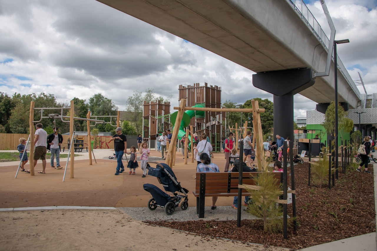
Playground near the rail bridge in Preston
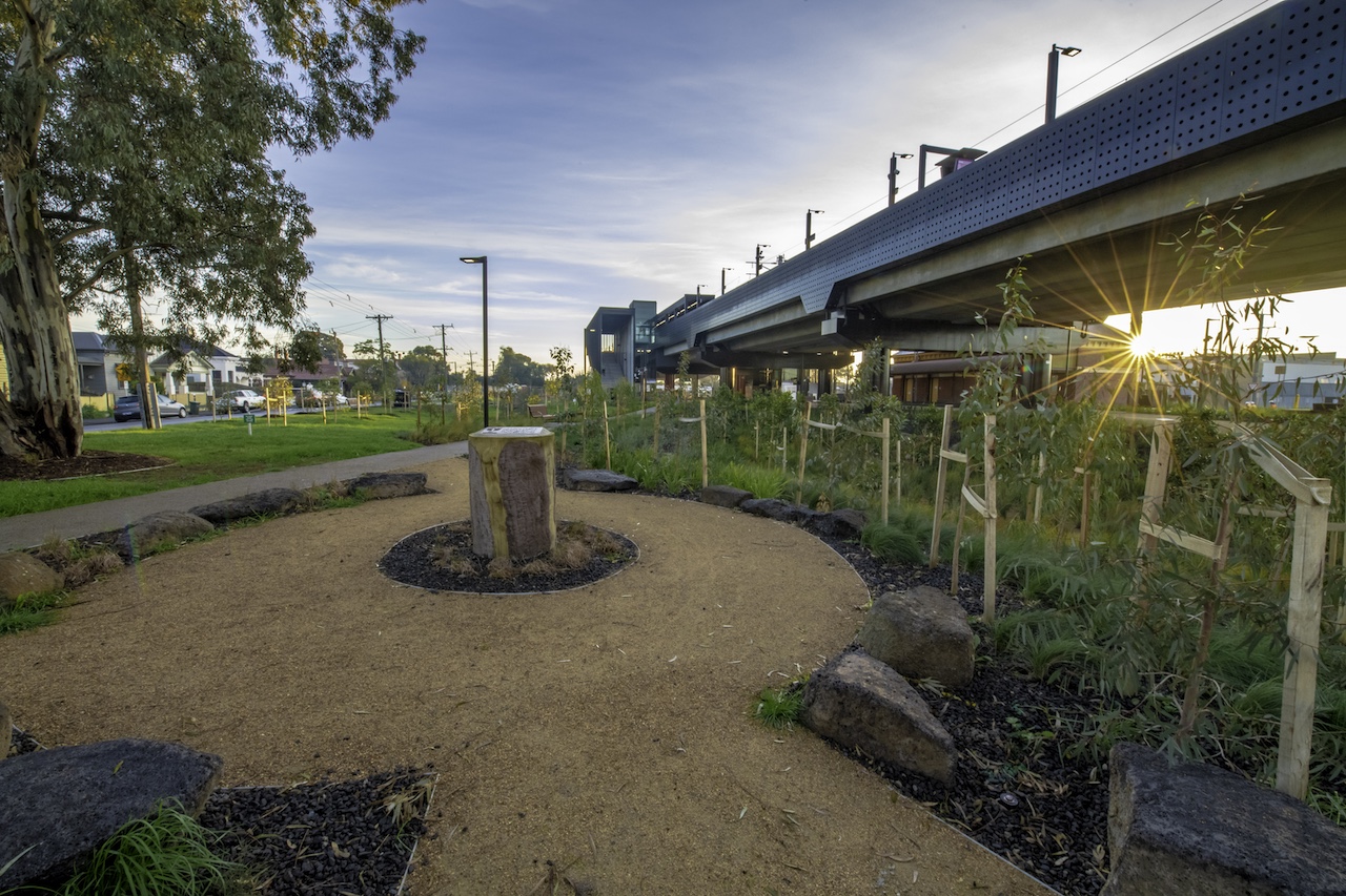
Yarning Circle at Moreland Station
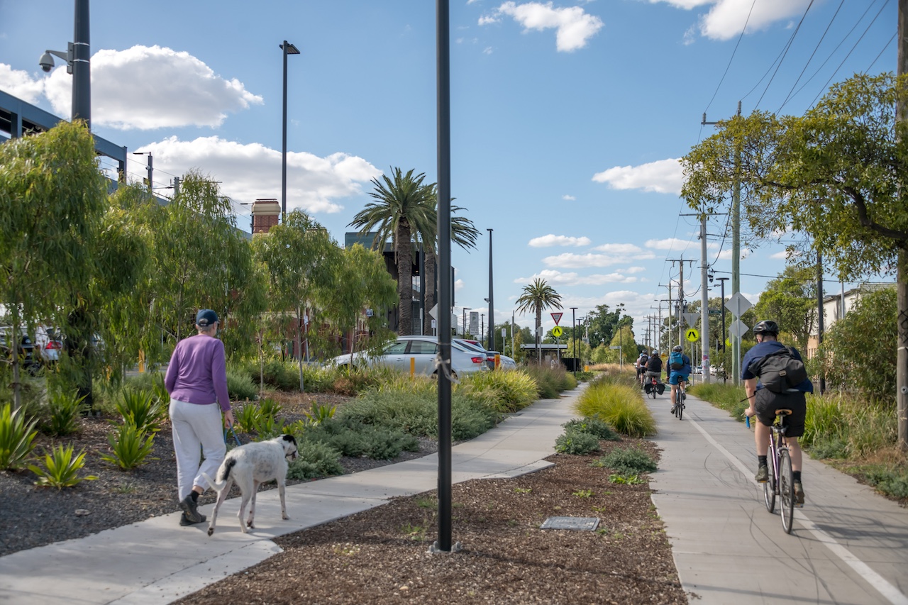
Separated bike and pedestrian paths at Moreland Station
We want to hear from you
As we continue planning to remove these dangerous and congested level crossings, we want to hear from you.
Share what you love about Brunswick and Parkville and how you move around the area to help us achieve the best outcome for your community.
Your feedback and technical and engineering requirements will help shape the project’s concept designs, which we will share over the coming years.
Take our survey
Visit Engage Victoria to take our survey and have your say by 11.59pm, Sunday 20 October.
If you would like a survey sent to you, please call us on 1800 105 105 or email contact@levelcrossings.vic.gov.au
Join us to learn more
Join us at one of our information sessions where you can:
- learn more about the project
- ask the project team questions
- share what you love about Brunswick and Parkville and how you move around the area.
Bookings are required. Register for a session and ask a question at Engage Victoria.
See us in person
Where: T.O.M.S Place,1 Tripovich Street, Brunswick
When:
- 5.30pm to 8.30pm, Wednesday 2 October
- 5.30pm to 8.30pm, Thursday 10 October
- 10am to 1pm, Saturday 12 October
Online via Zoom
When:
- 6pm to 7pm, Thursday 3 October
- 12.30pm to 1.30pm, Tuesday 8 October
- 6pm to 7pm, Wednesday 16 October
Your new stations
We’re building new accessible stations in Brunswick’s north and south to provide direct connections to train services, and residential areas, RMIT University, community and education facilities, employment, retail and dining options.
The 3 stations at Anstey, Brunswick and Jewell are within 1500m of each other, making among the closest stations on the network.
Strategically located, the new stations in Brunswick’s north and south will be located between 200m to 450m from the current Jewell, Brunswick and Anstey stations.
Each station will offer convenient access with 2 entrances, one at each end of the platforms, making them highly accessible to the surrounding areas.
Built in accordance with current safety and accessibility standards, both entrances will be fully accessible with covered stairs and lifts providing direct access to the platforms above for all passengers.
For the majority of people, access to the new stations will be improved with new, safer cycling and walking connections. For some passengers, the travel time to the station will be shorter, and in cases where it is longer, the increase is expected to be less than 2 minutes.
Technical and engineering assessments found that building new stations in Brunswick’s north and south:
- reduces heritage and construction impacts
- increases open space
- paves the way for future upgrades including extra train services.
Heritage
The project will seek to preserve important heritage assets including Victorian heritage-listed station buildings, boxes, gates and other infrastructure.
A key consideration of the rail bridge design was not impacting significant locations, including the Former Brunswick Gas & Coke Retort House and Brunswick Baths.
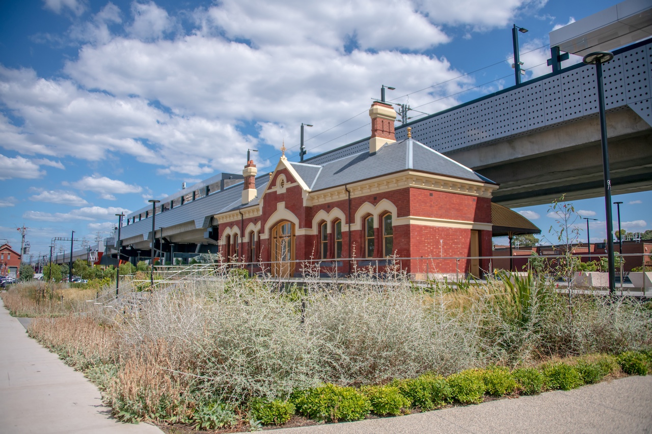
Heritage Coburg Station underneath the rail bridge in Coburg
Map of Brunswick and Parkville area
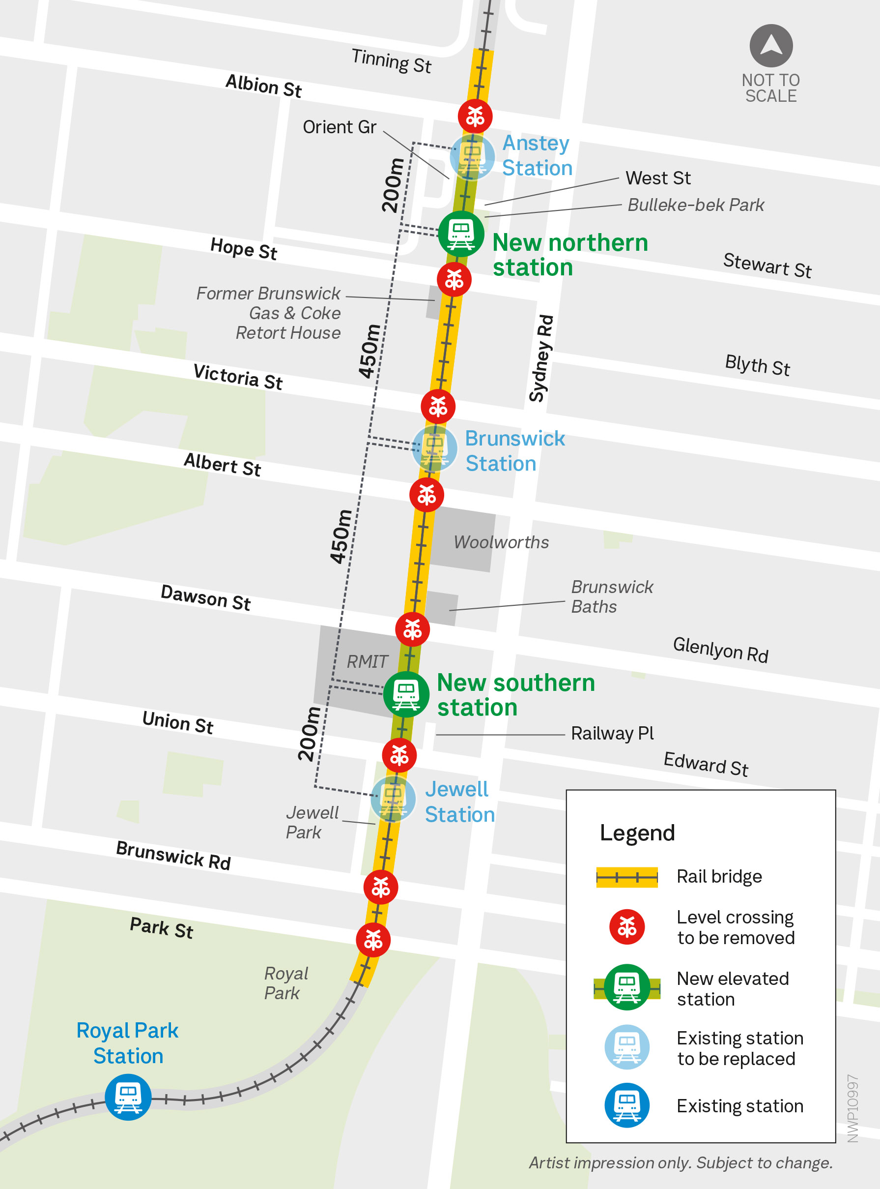
Artist impression only. Subject to change
New station locations
The existing stations at Jewell, Brunswick and Anstey will be merged into 2 new state-of-the-art stations in new locations in Brunswick’s north and south.
To determine the new locations, we considered the additional distance for passengers to access the new stations, improving access for the broader community and limiting the impact on current and future rail operations.
Northern station
The new northern station will cater to the neighbourhood’s rapidly growing residential community.
The new station will:
- be centrally located between West Street and Hope Street
- provide access to Bulleke-bek Park, West Street and Orient Grove via a northern entrance
- have a southern entrance to provide access to Hope Street.
To avoid impact to the Victorian heritage-registered and state-significant Former Brunswick Gas & Coke Retort House and more significant compulsory property acquisition, the station could not be located south of Hope Street.
The station could not be located further north as it will require more significant compulsory property acquisition, increased passenger walking distance to the new station and limits future rail operations.
Southern station
The new southern station will be on the doorstep of the world-class RMIT University Brunswick campus and the iconic Brunswick Baths.
The new station will:
- be centrally located between Dawson Street and Union Street
- provide access to Dawson Street via a northern entrance
- have a southern entrance to provide access to Railway Place and Union Street
- connect passengers to RMIT University, Brunswick Baths, Brunswick Library, Brunswick Town Hall, and future precincts such as The Saxon Project, a cultural and community hub.
The station location has a wider rail corridor which provides more space for the station precinct and separated bike and walking paths.
The station could not be located further north due to the narrow rail corridor and Brunswick Baths, and close proximity to the new northern station.
To learn more about the station locations visit our project page.
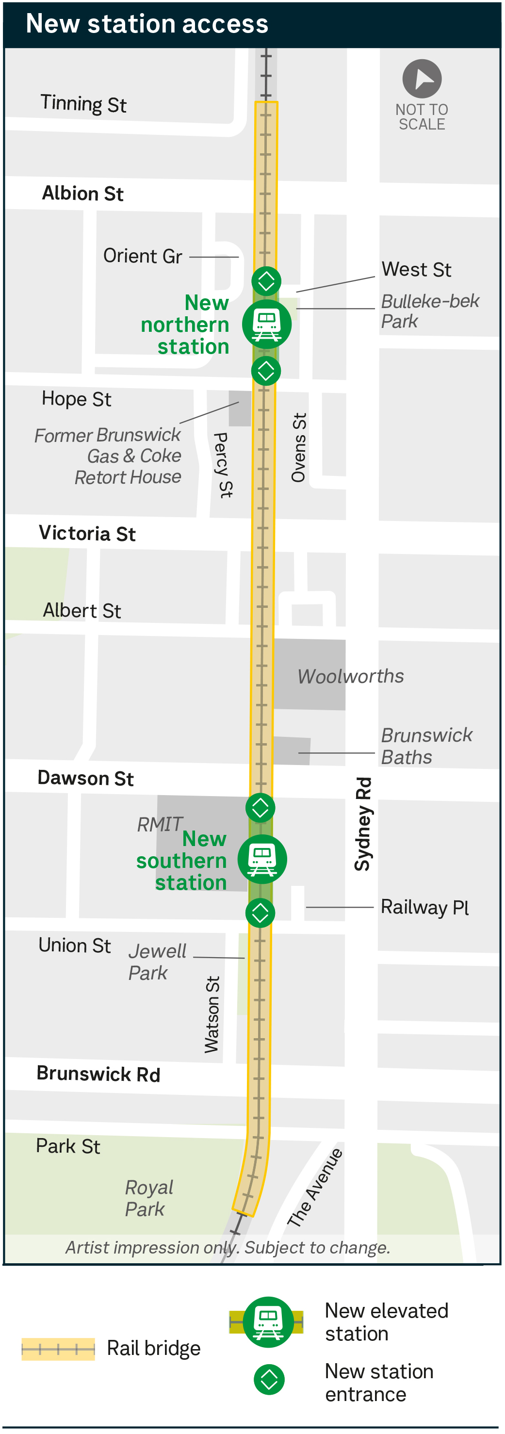
Artist impression. Subject to change
New community open space
Beneath the new rail bridge, we’ll create 2 MCGs worth of new community open space transforming the former rail corridor into new public space.
This open space will sit both under and on either side of the rail bridge and will be shaped by consultation from the local community.
Opportunities for this open space from other projects include half-size basketball courts, playgrounds, BBQs and recreational space, dog parks, table tennis tables, skating and parkour parks and exercise equipment.
There will also be room for green open space and opportunities for new trees and landscaping.
Local feedback will be important as we develop designs for the new open space.
As the design progresses over the coming years, we'll have more information about how you can get involved in creating this vibrant new space for the community.
The project will also transform the Upfield Bike Path by delivering separate bike and walking paths from Moreland Road in the north, to Park Street in the south.
The new bike path will provide safer and quicker connections for everybody.
Pedestrians will also get a new safer path under the rail bridge.
These new paths will provide more accessible active transport options to get to local shops and dining precincts, schools and educational facilities and nearby activities.
Across Melbourne, our experience has shown that where we’ve built a rail bridge over the roads, the new open space and cycling and walking paths are valued and well used by the community.
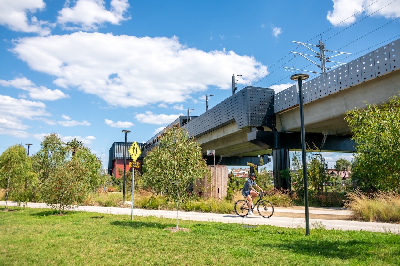
New landscaped areas at Moreland Station
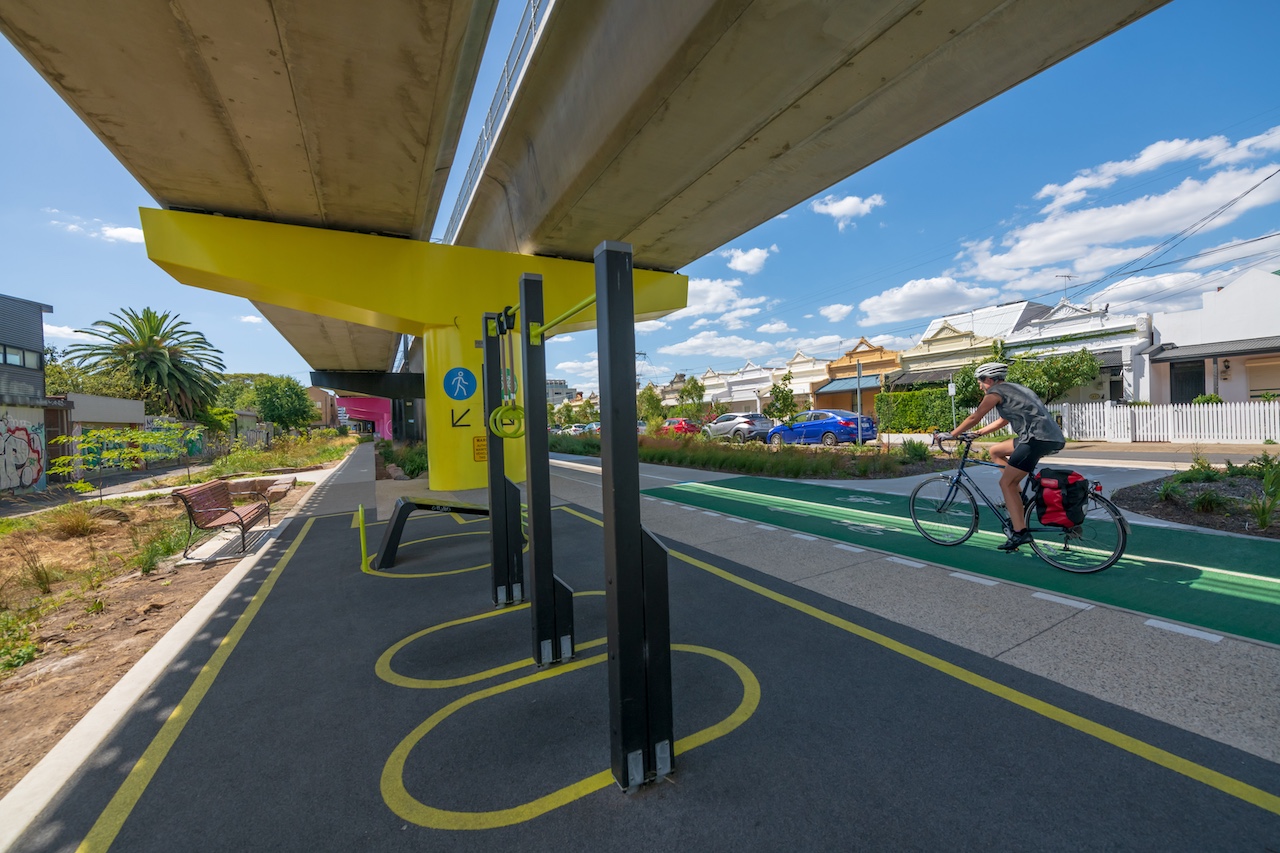
Exercise equipment and bike and pedestrian paths along the open space in Coburg
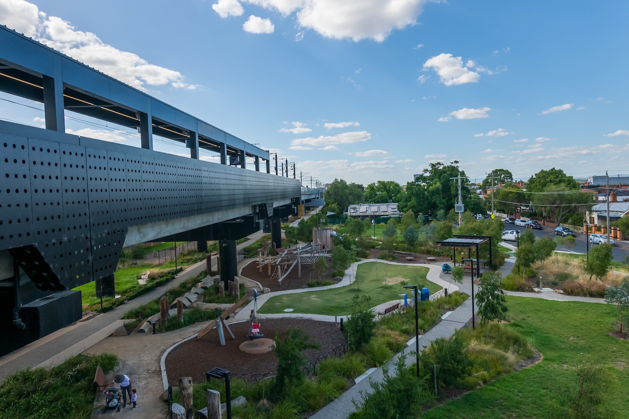
Playground near the rail bridge at Moreland Station
Next steps
Consultation is underway to better understand how locals move around the area and what they love about Brunswick and Parkville.
This input, along with technical assessments and engineering requirements, will inform concept designs.
We’ll come back to the community with more information and concept designs from 2027.
This will include opportunities to help shape key elements of the design, like walking and cycling connections, accessibility, landscaping, open space and station precinct design.
Stay up to date
The best way to stay up to date with the project is to:
- Read more about the project on our project page
- To have your say and ask questions visit Engage Victoria
- To subscribe to email updates go to our subscribe page and select Brunswick
- Call us on 1800 105 105 or email contact@levelcrossings.vic.gov.au
- For languages other English call 9209 0147
- Follow us or send us a private message on our Facebook page
Project timeline
2022
- Project announced
2024
- Visions and Values community consultation
2025 to 2026
- Site investigations and planning
2027 to 2028
- Early concept designs released
- Community consultation
- Further community consultation on refined designs
- Early works
2029
- Construction
2030
- Construction
- Boom gates gone for good
- Stations open
2031
- Community space open
* Timeline subject to change.