9 April 2025
Final designs revealed
We’re making the Frankston Line level crossing free by removing all 27 of the dangerous and congested level crossings by 2029 and building 17 new stations, improving safety, reducing congestion and allowing more trains to run more often.
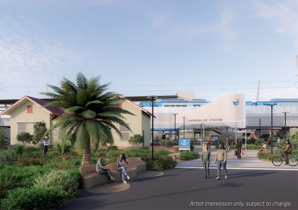
We’re removing the level crossings at McDonald Street in Mordialloc and Station Street in Aspendale by building new rail bridges. We’re also closing the Bear Street level crossing in Mordialloc and building a new Mordialloc Station in 2026.
We have now released final project designs, ahead of major construction starting in the coming months.
The final designs showcase updates to nearby intersections, landscaping and the look and feel of the station precinct.
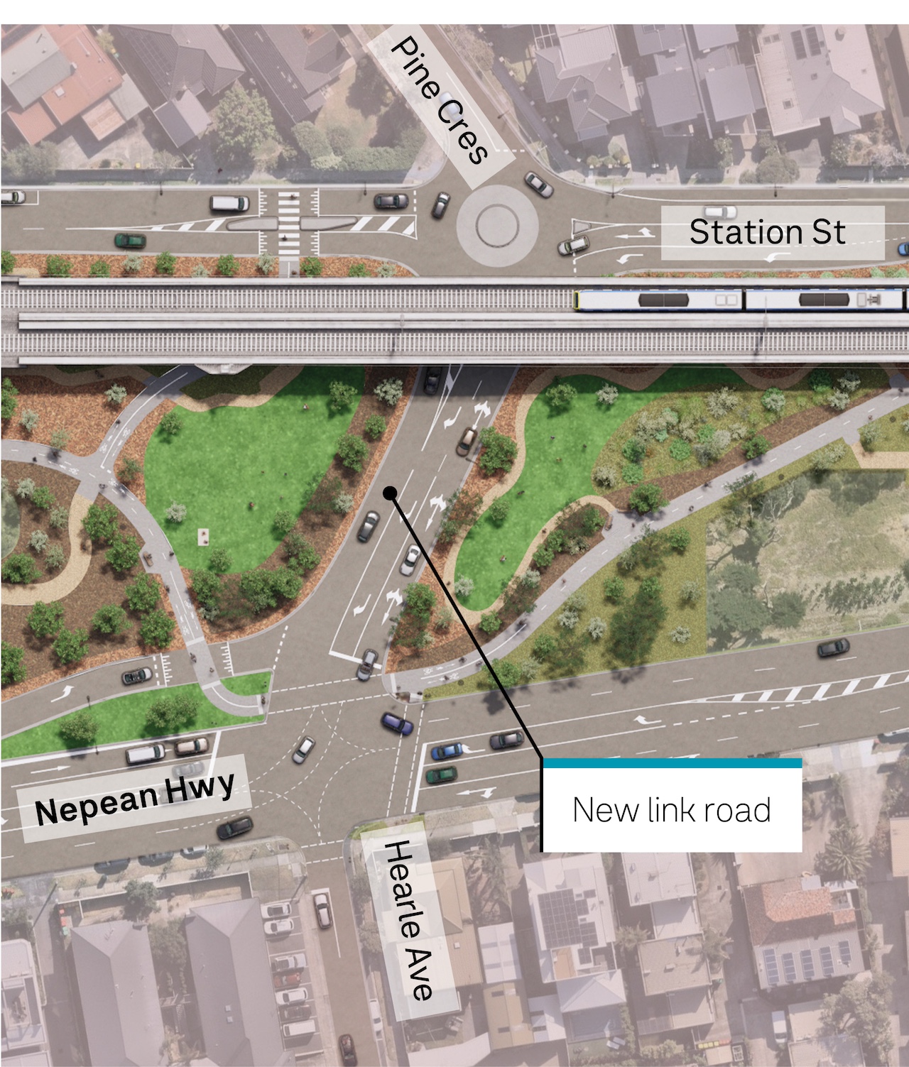
We’ve worked with key road stakeholders to introduce a safe left turn from the new link road near Station Street onto Nepean Highway in Aspendale, improving travel options.
The station and bridge piers will feature a natural colour scheme, reflecting Mordialloc’s bayside location.
Works are continuing throughout the area as we prepare for major construction. We’ll continue to relocate services, install safety barriers and fencing and prepare the ground for the new rail bridge.
Read on to find out more about the final project designs.
Car parking updates
Commuter car parking
Commuter parking will be consolidated under the new rail bridge, providing easier access to the new station. There will be no net loss of car parks, meaning commuters will have access to more than 200 car spaces, including 8 accessible spaces. Five pick-up and drop-off bays will be available on Albert Street.
There will be some adjustments made to on-street car parking, to make way for traffic and road changes, including:
- a new roundabout at Station Street, Aspendale to improve traffic flow
- a slip lane for vehicles turning left from McDonald Street onto Nepean Highway
- pedestrian crossings on Albert, McDonald and Station streets
- a signalised intersection at the new link road at Nepean Highway, Aspendale
- Albert Street becoming one way, to keep traffic flowing smoothly through the new boom-gate free area.
We’ll build new car spaces at:
- Station Street, Aspendale
- Albert Street, Mordialloc.
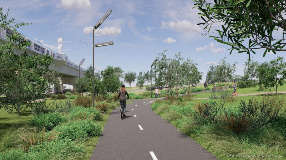
We'll build new walking and cycling paths in Mordialloc and Aspendale, connecting to existing paths near the station, Main Street and Attenborough Park.
Changes for pedestrians and cyclists
Kiandra Close, Aspendale pedestrian rail crossing closure
The Kiandra Close pedestrian rail crossing needs to close as it does not meet safety standards. Pedestrians can cross the rail line safely at Lyle Grove (300m/4 minute walk) or Station Street (850m/11 minute walk).
Once the project is complete, pedestrians can also cross at Pine Crescent (450m/6 minute walk). Both Lyle Grove and Pine Crescent will connect to signalised pedestrian crossings over Nepean Highway, providing safe access to the beach.
Mordialloc Stabling Yard underpass closure
The new rail bridges in Mordialloc and Aspendale will descend to ground level and connect with the existing bridge over Mordialloc Creek. To enable this, adjustments need to be made to the nearby Mordialloc Stabling Yard. This will remove the space required to access the underpass, meaning it must close.
For more information, view our underpass closure fact sheet.
Bike lanes on Station Street, Aspendale
To make way for road safety adjustments required for the new intersection, on-road bike lanes will be removed on Station Street between approximately Attenborough Road and James Avenue. Cyclists are encouraged to use the new shared use path through Groves Reserve.
Traffic updates
We’ve finalised elements of the project design, including traffic and intersection arrangements.
Left turn on to Nepean Highway from new link road
The project design now includes a left turn from the new link road onto Nepean Highway, allowing drivers to go straight, right or left at the new set of lights.
This is the positive result of community feedback and ongoing engagement with the Department of Transport and Planning and Kingston City Council.
To ensure this turn is safe for all road users, vehicles 8.8m and over will not be allowed to turn left at the new link road onto Nepean Highway.
Left turn from the new link road onto Nepean Highway
Other traffic updates
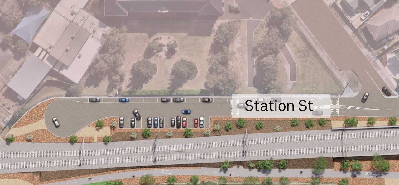
We’ll build a new turning circle at the end of Station Street near Mordialloc College, allowing cars to turn around safely during school pick up and drop off. We’ll also build 30 new car spaces at the end of Station Street.
New turning circle at the end of Station Street near Mordialloc College
We’ll then landscape near the former level crossing site, creating a continuous flow of green space from Attenborough Park to Groves Reserve.
The current connection between Nepean Highway and Station Street, Aspendale will be replaced by the new link road further down Nepean Highway.
The existing Nepean Highway and Station Street intersection traffic lights will be replaced with a give way sign to maintain access to Scope Disability Services and support traffic flow.
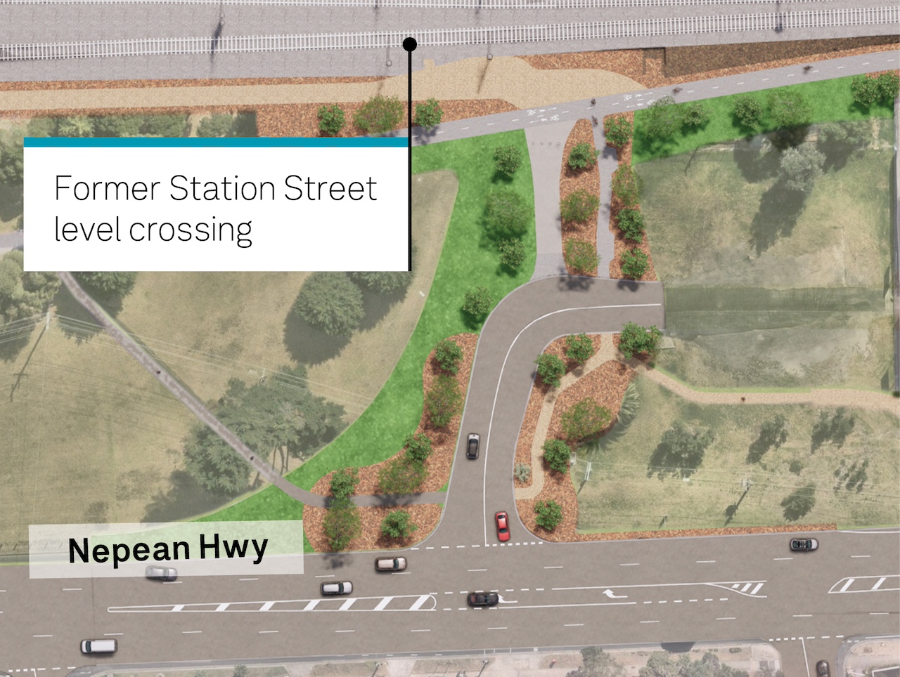
Landscaping near the former level crossing site
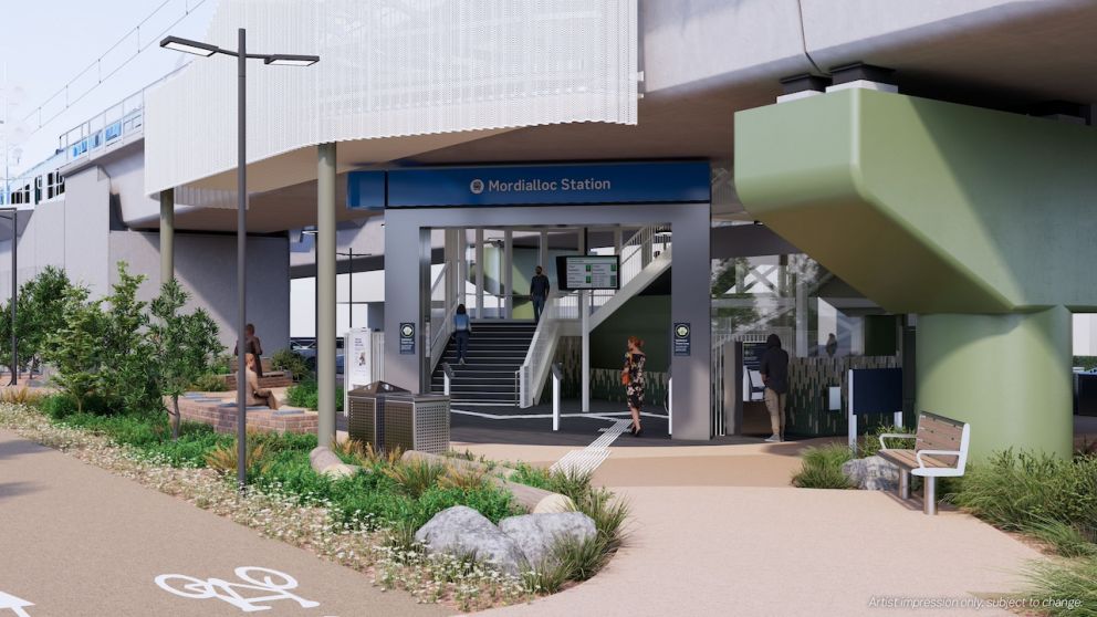
Your new Mordialloc Station
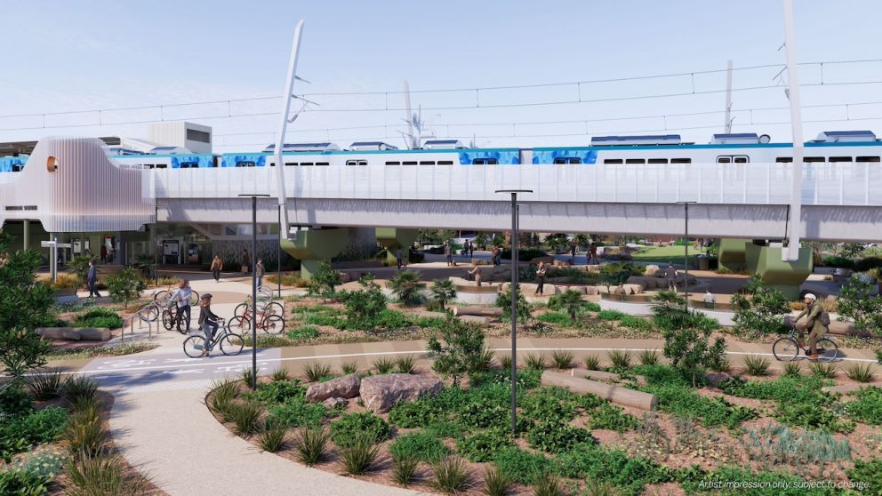
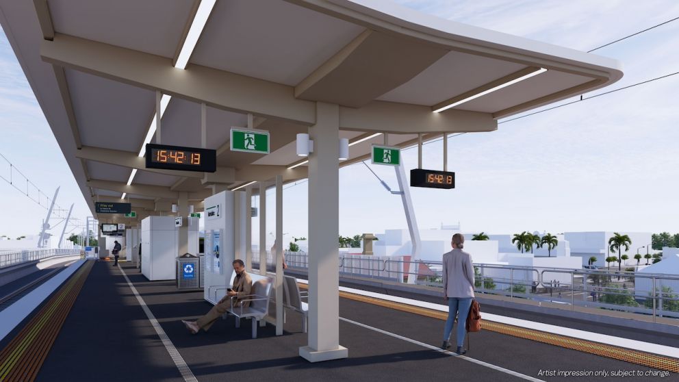
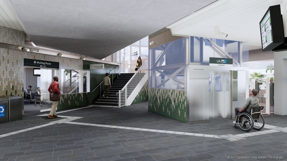
The new elevated premium station will feature modern facilities, all-abilities access, improved lighting, public spaces and diverse landscaping.
Find out more and see a map of the station precinct in our Mordialloc Station fact sheet.
Finishing touches at Mordialloc Station
We've finalised station features, including planting, colour palette and bike parking locations.
Rail bridge and station finishes
The bridge piers and crossheads in Mordialloc will be painted ‘Pale Eucalypt’, and the retaining wall and abutments will be painted ‘Warm Neutral’, inspired by the native, coastal vegetation seen in Mordialloc.
Off white perforated metal screening will be installed on the rail bridge over McDonald Street and along sections of the station. In Station Street the piers, crossheads, retaining wall and abutment will be painted 'Warm Neutral'. Similar shades of tiles will feature in the station, complementing the exterior building.
Landscaping
Throughout Mordialloc and Aspendale, we’ll plant more than 1,000 trees and over 85,000 plants, shrubs and grasses.
Native vegetation will help to support local biodiversity, while providing a low-maintenance and drought tolerant solution.
Station features
The station forecourt will feature raised garden beds, seating and landscaped areas, creating a vibrant and inviting space. The station will include:
- flowering gums
- river red gums
- drooping sheoaks
- blackwoods
- banksias
For more information about landscaping, view our landscaping fact sheet.
Parkiteer and bike hoop locations
The new Parkiteer will provide the capacity to securely store 26 bikes, in addition to bike hoops throughout the precinct providing storage for an extra 46 bikes.
The new Parkiteer will be located next to the existing Platform 1 station building, which will be incorporated into the design as the new Protective Services Officer (PSO) office.
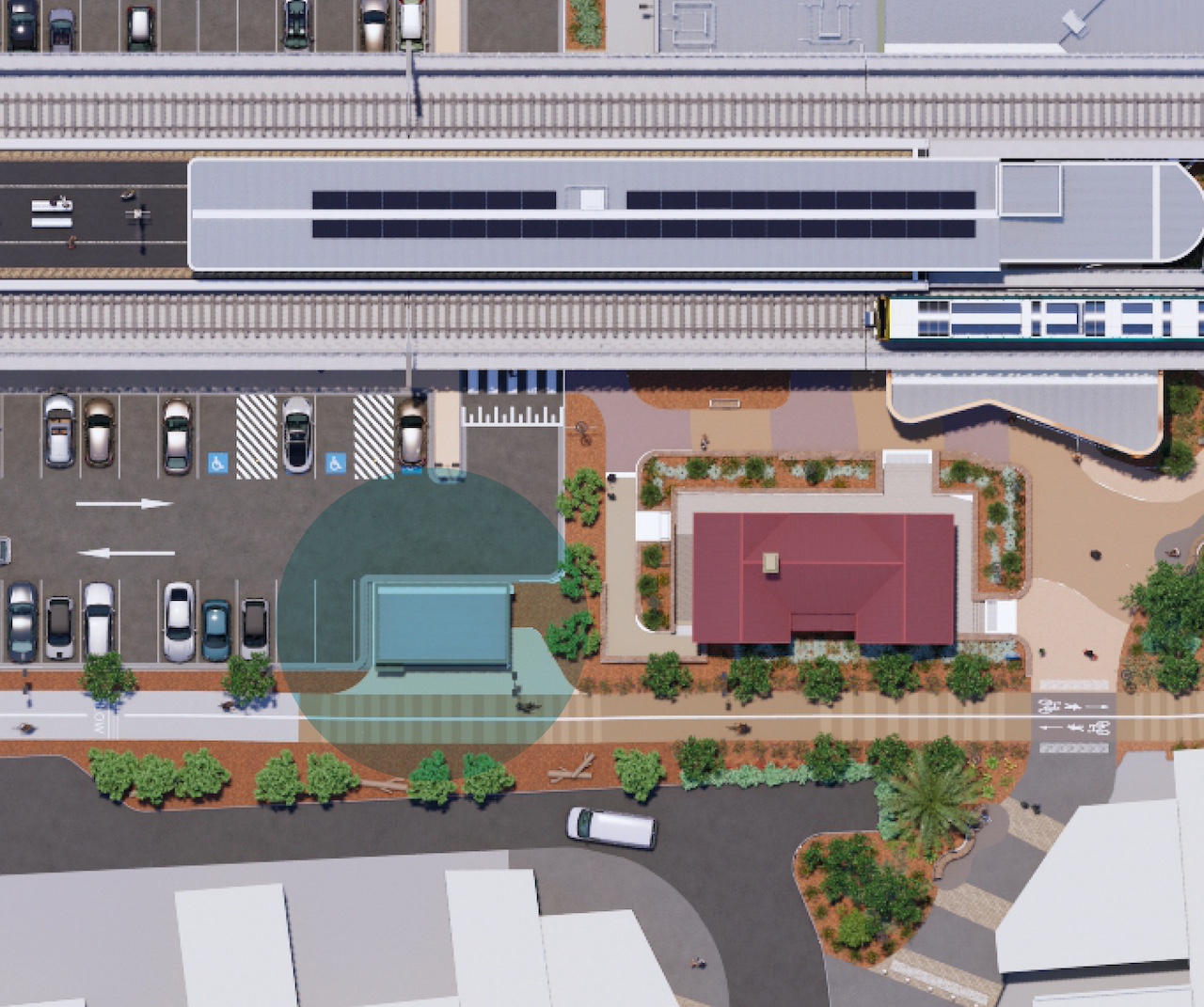
New Parkiteer located next to the existing Platform 1 station building
View the final designs
Find out more about the final designs for the Mordialloc Level Crossing Removal Project.
The final designs include updates to local intersections, landscaping, and the overall look and feel of the station precinct.
Join us online to hear more or view the designs in person at an information session.
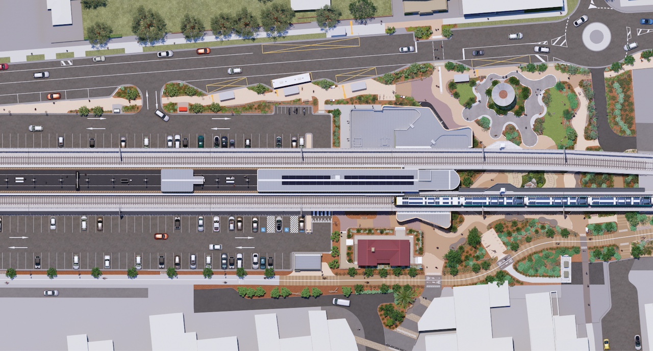
Mordialloc Station precinct map
Aspendale Level Crossing Removal Project
In October 2022, the Victorian Government made the commitment to remove every level crossing on the Frankston Line. This includes the removal of the Groves Street level crossing and building a new premium Aspendale Station with modern facilities.
This project will be complete by 2029, with design work yet to begin.
We will update the community as the project progresses.