Stage 3 of the Echuca-Moama Bridge Project involved building a new link road between Echuca and Moama. The new link road includes:
- a new 2-lane road (1 lane in each direction) with sealed shoulders north of the new roundabout on Warren Street in Echuca to the Cobb Highway in Moama
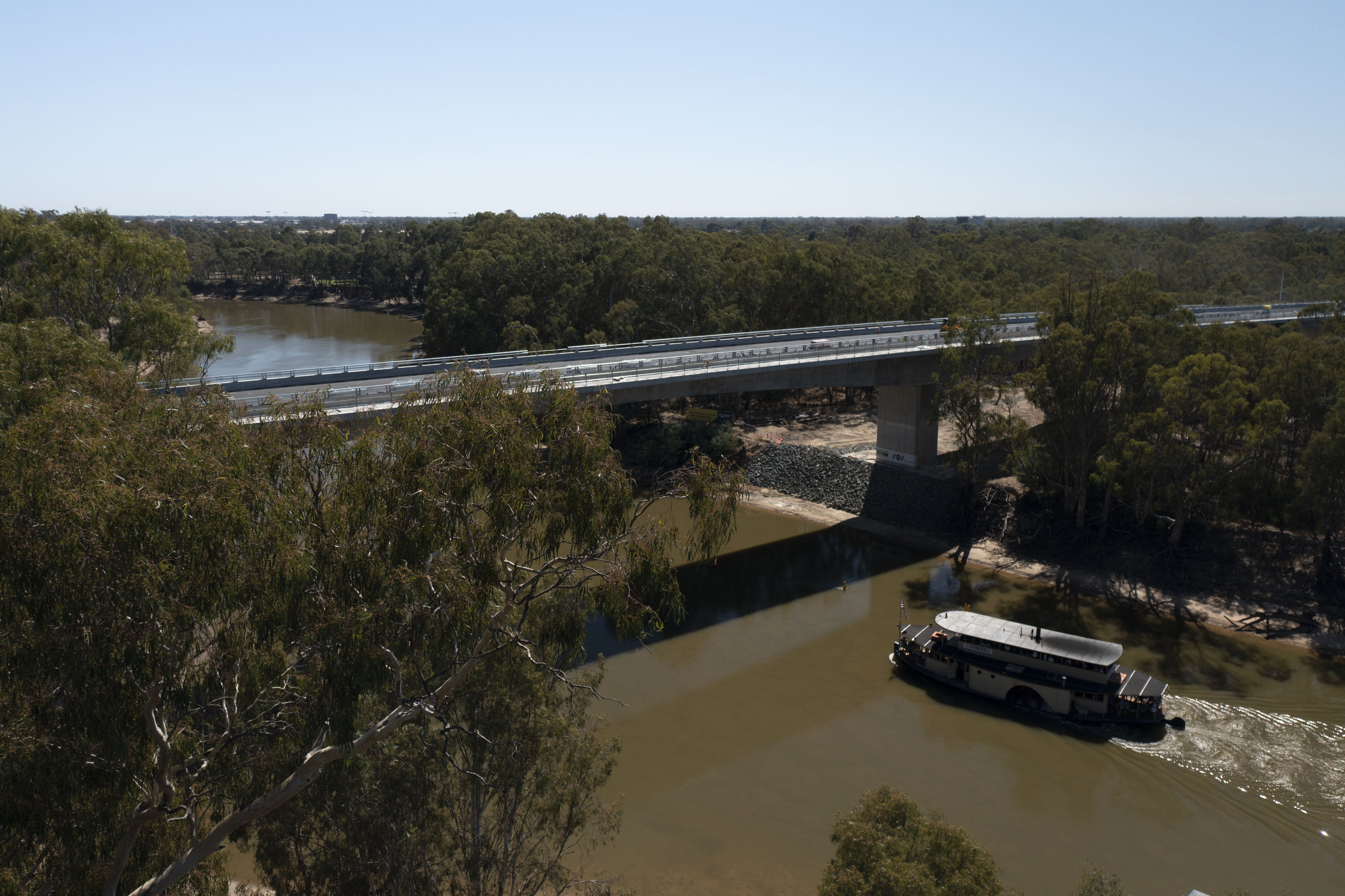
- new bridge over the Murray River and floodplain
- new bridge over the Campaspe River and floodplain
- two new flood relief bridges
- safety barriers
- noise walls
- a new safe and scenic shared walking and cycling path along the route and over the new bridges.
The bridges integrate with the surrounding natural environment, with a simple and clean ‘bridges through the treetops’ design, and clear spans over the 2 rivers minimises environmental disturbance to the waterway and aquatic habitat.
McConnell Dowell delivered the contract to build Stage 3. Works started in March 2020 and were completed in April 2022.
Video
Want to travel your new river crossing? Click play and take a journey through the treetops.
Habitat improvement works
During late 2019, we installed 2 types of additional habitat hollows in Victoria Park: traditional nest boxes and carved hollows to provide more shelter for local wildlife. This was in preparation for the start of major works on Stage 3.
For more information about these works visit our Environment page.
Dhungala Dreaming
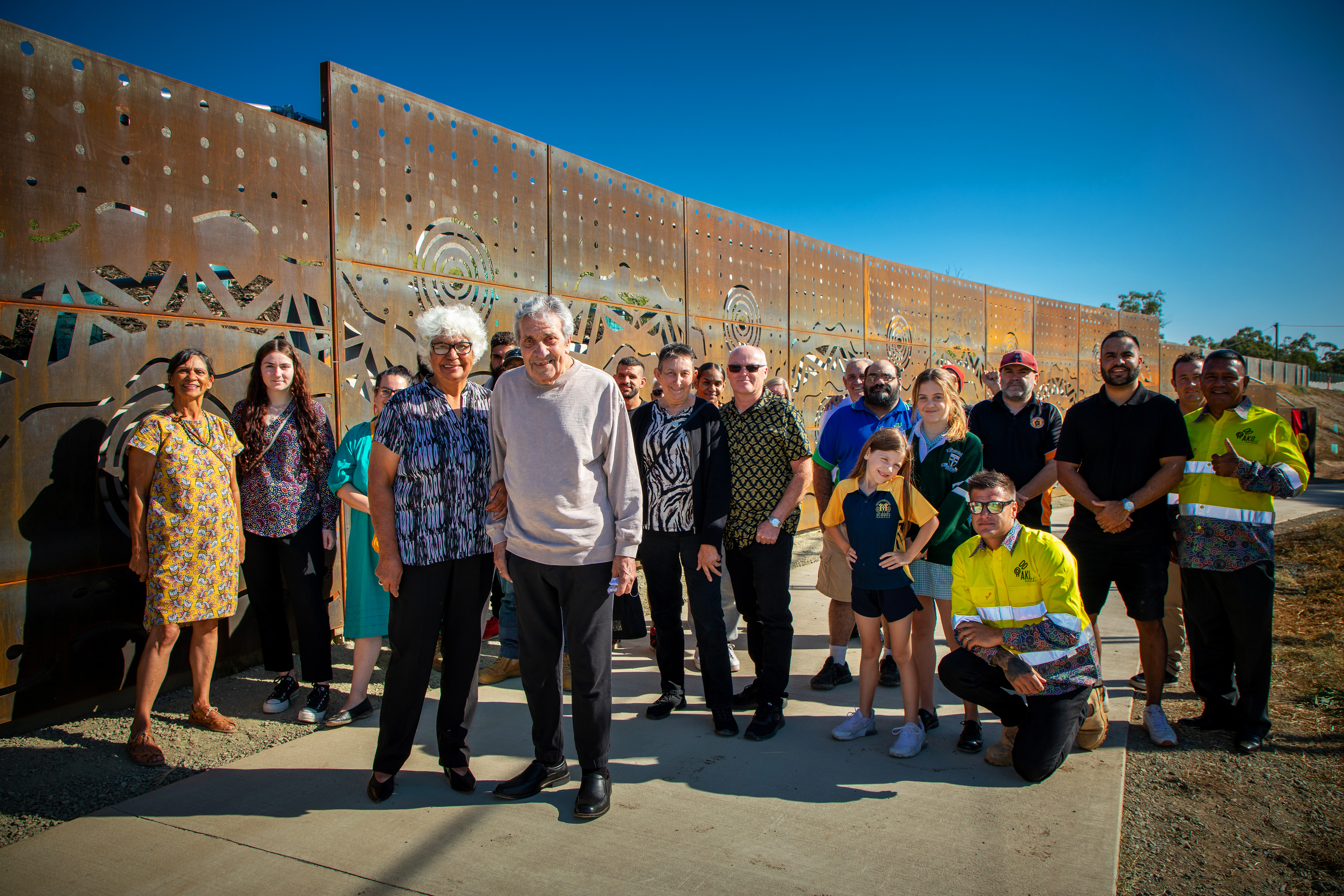
Yorta Yorta elder Aunty Judy Atkinson joined by special guests at the unveiling of the monument.
An important new monument unveiled on the Echuca-Moama Bridge Project represents the tale of The Woman and The Serpent, a Dreamtime story about the Yorta Yorta people and the creation of the Murray River.
The artwork was created by local artist, Yorta Yorta elder Aunty Judy Atkinson using 17 steel panels. The artwork is named Dhungala Dreaming – ‘Dhungala’ being the Yorta Yorta name for the Murray River.
The artwork has been installed along the new shared walking and cycling path, near the Echuca Lawn Tennis Club in Victoria Park.
Naming the new bridges
In 2019, the United Nations designated the period between 2022 and 2032 as the International Decade of Indigenous Languages, with the aim of preserving, protecting, and promoting indigenous languages around the world.
Indigenous naming is a priority across the entire Victorian and NSW transport portfolio, and we’re committed to supporting and celebrating Aboriginal culture and language.
Language plays an important part in the preservation of culture and connection for Traditional Owners, who have strong ancestral connections to Country. These connections link past, present and future generations to one another.
In Echuca and Moama, we’re taking vital steps to protect, revitalise and promote Indigenous languages. We’ve worked closely with Yorta Yorta Aboriginal Nation Corporation, Moama Local Aboriginal Land Council and Cummeragunja Local Aboriginal Land Council to identify Aboriginal language names that resonate with the local area, and the history and customs of the Traditional Owners.
First Nations People have lived alongside the Murray and Campaspe rivers for thousands of years. The local rivers are part of their identity, as it’s where they grew up and found their livelihood and where they continue to live on Country to this present day.
The name chosen for the new bridge across the Murray River is ‘Dhungala Bridge’, meaning Murray River Bridge in Yorta Yorta language. The name chosen for the new bridge across the Campaspe River is ‘Yakoa Bridge’, meaning Campaspe River Bridge in Yorta Yorta language.
These new names align with the essential themes of nature and connection, acknowledging the geographical location of the new bridges.