A greener, better-connected west
The West Gate Tunnel Project is more than a road, we are also delivering new cycling and walking paths and creating nearly 9 hectares of new open space.
Our commitments
By the time the project opens, we will deliver:
- new community parks and wetlands
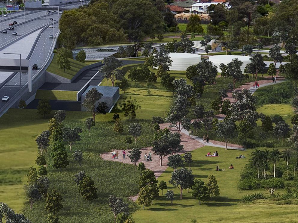
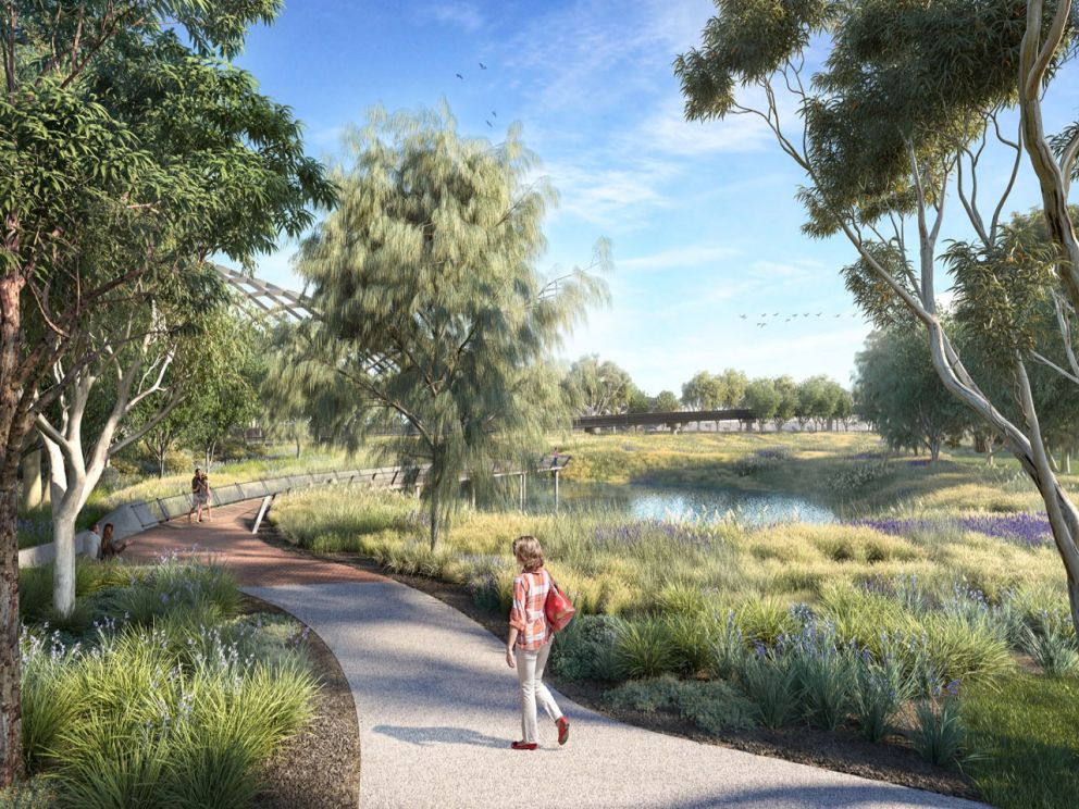
Close to 9 hectares of new parks and wetlands will be created, changing closed-off industrial land into spaces for communities to enjoy. - over 17,000 trees and vegetation
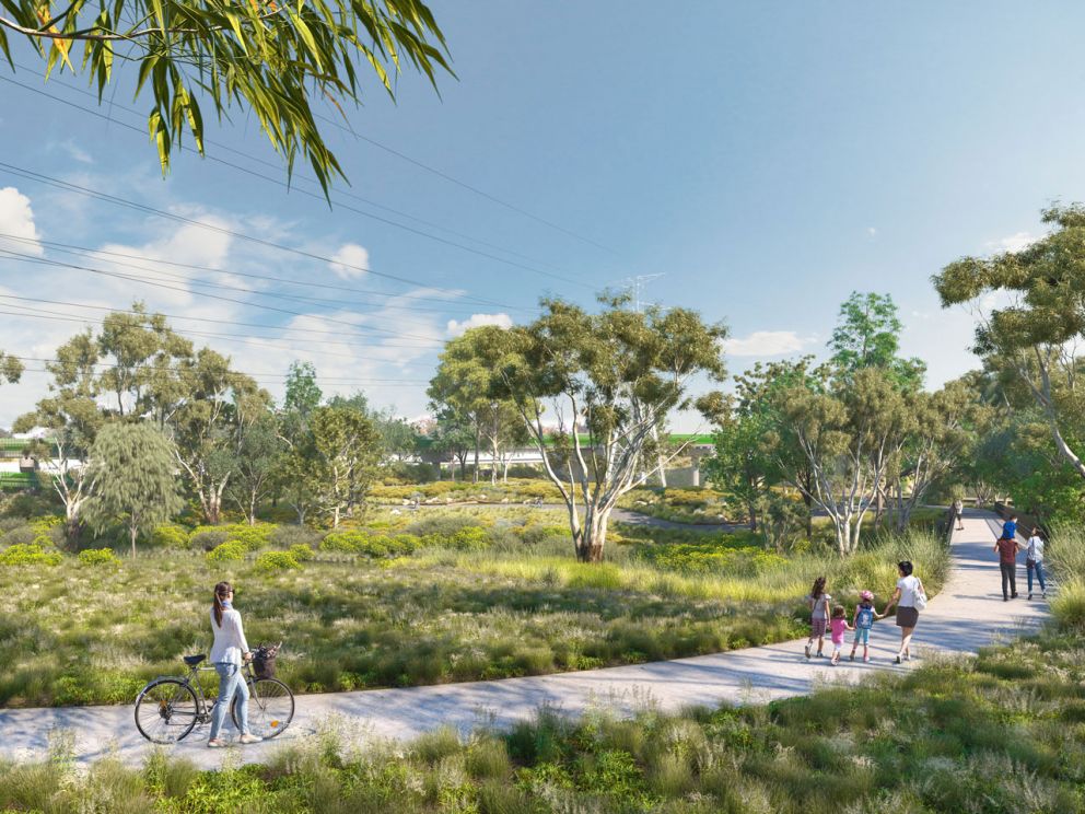
We’ll replace trees affected by the project and green the west with over 17,000 trees and tens of thousands of native and Indigenous shrubs and grasses being planted along the roads and around waterways and parks. - enhanced waterway environments
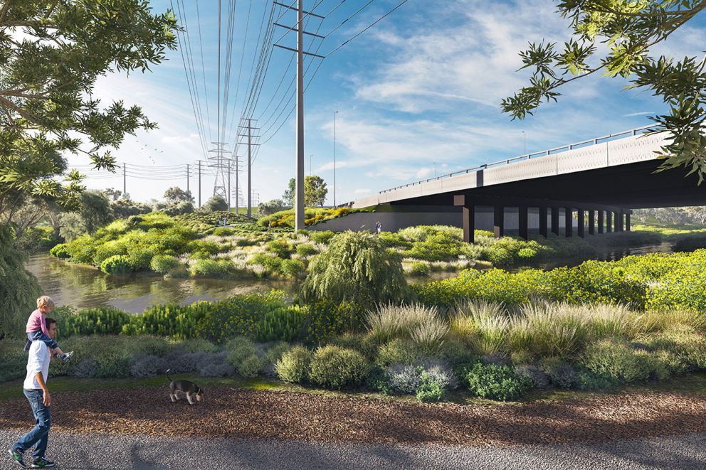
We’re helping build on the work of local groups to improve the health and habitat of creeks and waterways. Wetlands will be used to treat stormwater naturally and new plantings will help rehabilitate creek banks and develop animal habitats. - walking and cycling paths
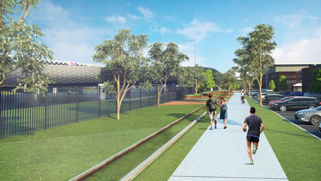
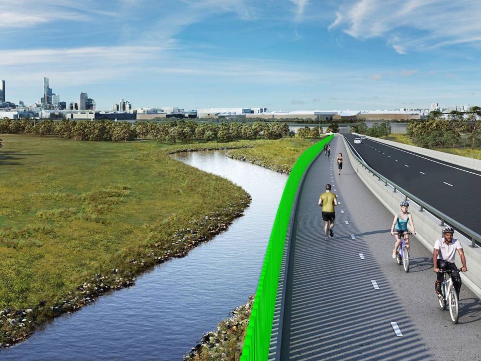
We are building over 14km of new and upgraded walking and cycling paths, including new links to parks, sports grounds, wetlands and popular trails.
Key locations
West Gate Freeway area
Along the West Gate Freeway area of the project covering the suburbs of Brooklyn, Altona North, South Kingsville, Spotswood and Yarraville, we will create a greener and better-connected west by:
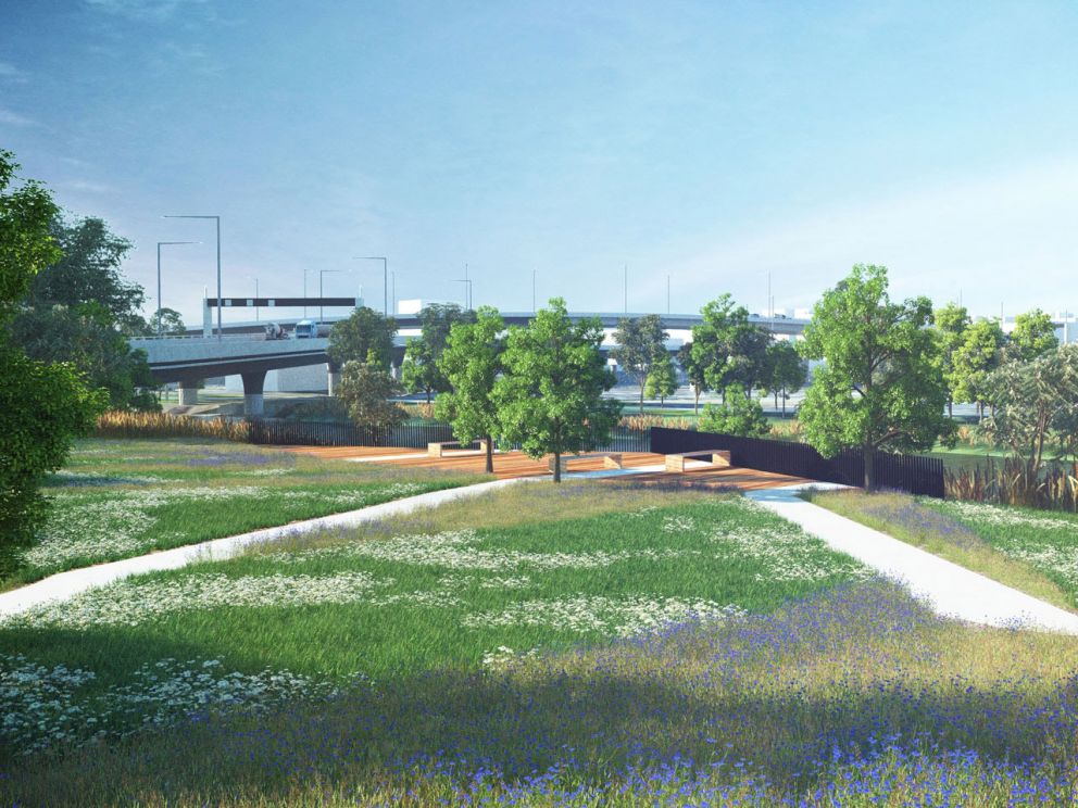
- turning vacant industrial land into new parks for the community at New Street on the border of South Kingsville and Altona North, and adding to Hyde Street Reserve in Yarraville
- completing the missing link in the Kororoit Creek shared use path with a direct connection to the Federation Trail
- highlighting the importance of the indigenous landscape of the creek through signage identifying significant species and their uses
- planting native tree species to increase tree canopy cover for the areas
- completing the missing link in the Stony Creek shared use path by linking Hyde Street Reserve, the adjacent industrial area, and Spotswood Station via Hall Street
- creating a unique nature play space in the new open space on New Street, delivering a natural playground for children to play and explore.
Whitehall Street and Maribyrnong River
At the Whitehall Street and Maribyrnong River areas, we will deliver a greener and better-connected west by:
- turning industrial land into new open space and wetlands which will include a boardwalk, interpretive artwork and seating
- providing a new, naturalised environment that directly links Yarraville Gardens to new open spaces via the new shared use path over
- Whitehall Street and down to the Maribyrnong River
- new landscaped recreation space on the Maribyrnong River frontage, incorporating the extended rail line and celebrating the area’s heritage through interpretive wayfinding design
- retaining the existing anchor sculpture on Maribyrnong Street at the Maribyrnong River as a symbol of the area’s historic river trade.
Moonee Ponds Creek, Footscray Road and CityLink connections
For the Moonee Ponds Creek area, Footscray Road and under CityLink area of the project, we will create a greener and better-connected west by:
- Rehabilitating the unused rail land alongside Moonee Ponds Creek to provide more green open space, including 2 new tracks for BMX riders, scooter riders and skateboarders.
- Building a new walking and cycling bridge over Footscray Road for pedestrians and cyclists.
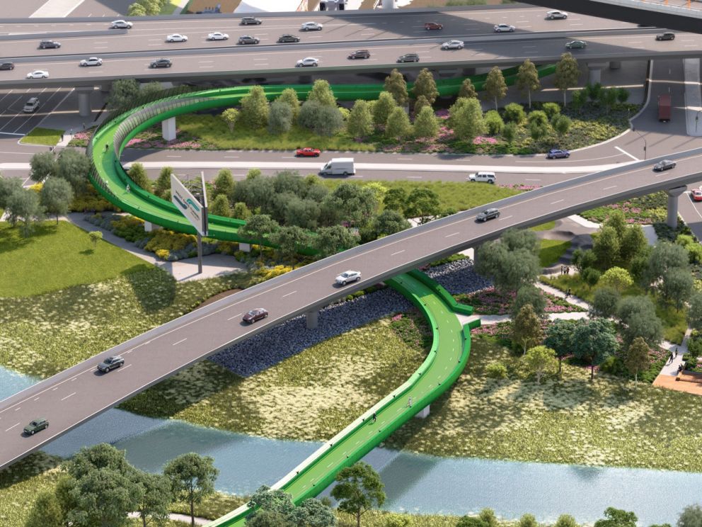
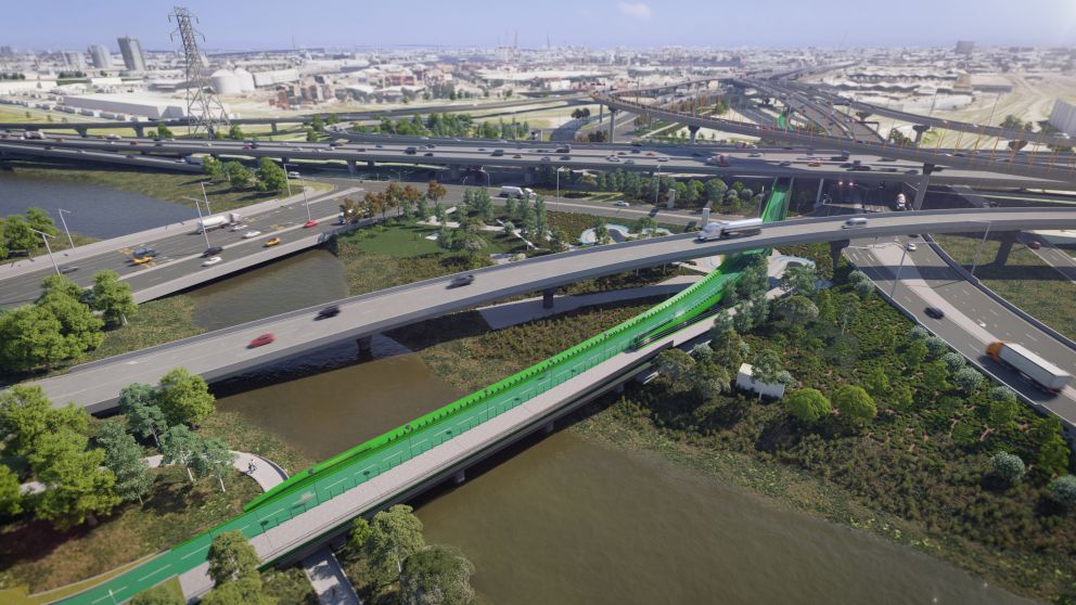
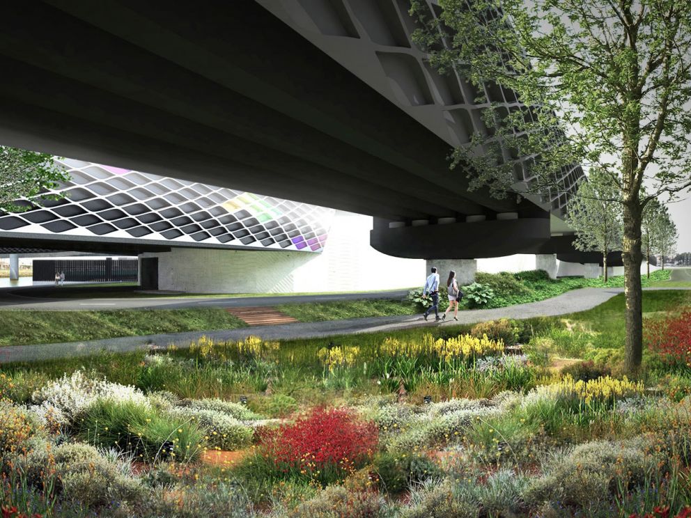
- Building a new 2.5km elevated veloway which will give cyclists a safe and express route to and from the city.
- Delivering a new shared use path bridge connecting North Melbourne to Dynon Road and Moonee Ponds Creek Trail.